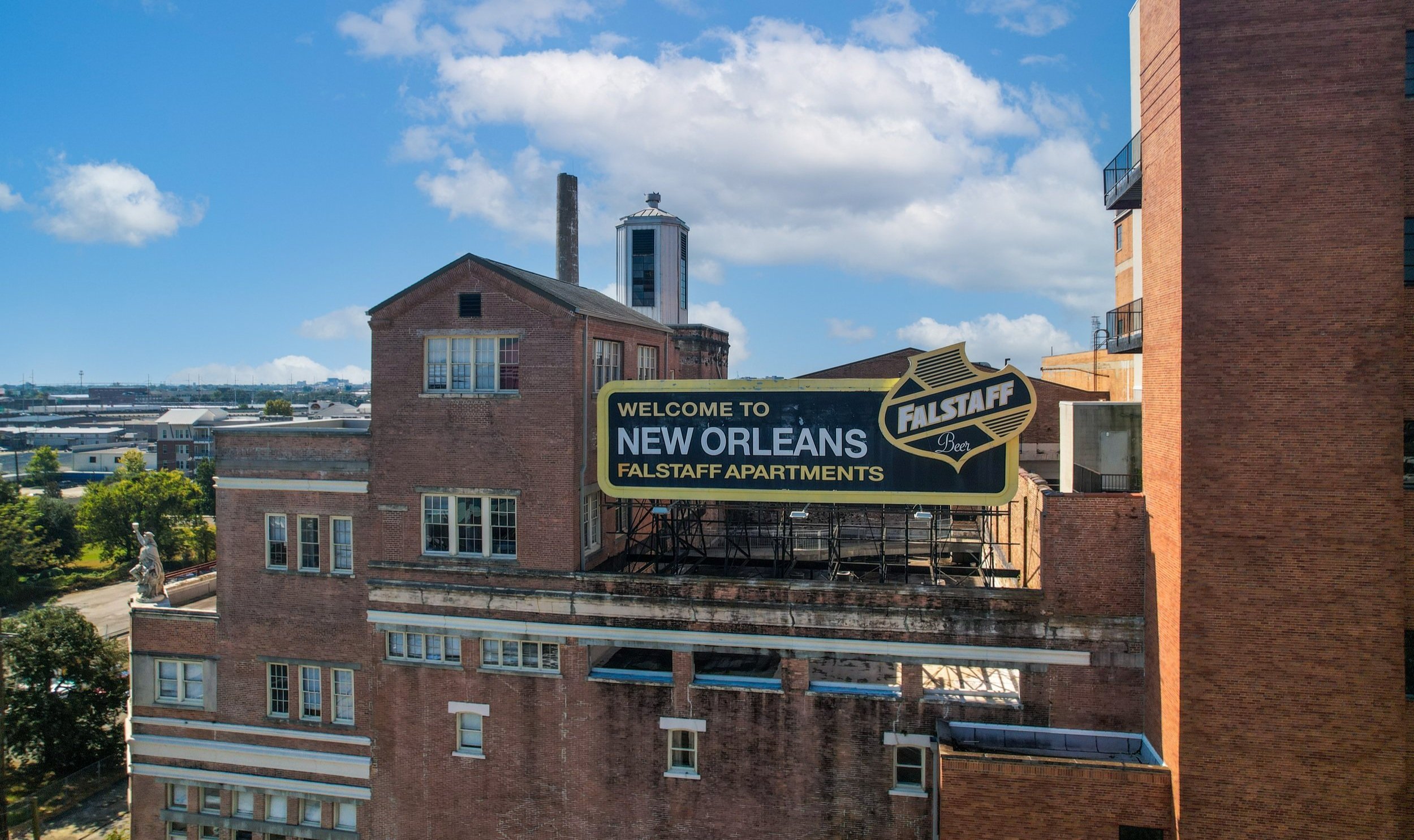
DRONE PROGRESS MONITORING
Track Your Project’s Progress with Precision and Efficiency
At 504 Drone Imaging, we offer state-of-the-art drone progress monitoring services designed to provide a clear, real-time view of your construction or infrastructure projects. Our drones capture high-resolution aerial imagery and data, giving you an in-depth perspective on project developments, no matter the scale.
Progress monitoring is the recurrent collection of information throughout a lifecycle to ensure the project is progressing as planned. Progress monitoring not only helps detect when something may have fallen behind but also prevents delays before they happen. Managers are alerted to issues as they arise and can implement solutions early before the issue slows everything down.
Assessments can be made on a daily, weekly, monthly, or quarterly basis depending on how often updates are desired.
Thanks to features like waypoints and geotagging, a drone can replicate the exact photo each time it flies, providing consistent views to compare changes over time as well as before and after shots.
Aerial videos provide data in motion. Video offers a 360° view of structures and assets on the construction site from multiple vantage points and angles. A view this comprehensive would have been unobtainable in the past without a manned aircraft(which is incredibly expensive).
Aerial mapping is an advanced form of data analysis that is fully customizable. Orthomosaic maps can provide accurate measurements for the entire site or a targeted, such as storage areas where materials and supplies are kept.
All of these types of aerial data (photos, video, maps) are used to improve planning and communication. Periodic updates provided through aerial imagery will help projects stay on schedule and in turn, keep them from going over budget. Aerial imagery can be shared across teams, with managers, and with off-site stakeholders and investors who may be interested in keeping up with the site.
Why Choose Drone Progress Monitoring?
Accurate & Real-Time Data: Drones capture up-to-date information quickly and accurately, allowing project managers to assess progress from any location.
Improved Decision-Making: With aerial insights, you can identify potential issues before they become costly problems, ensuring your project stays on track and within budget.
Enhanced Reporting: Our drones collect detailed images and videos, which can be compiled into easy-to-understand reports, complete with metrics like area measurements and volumetric analysis.
Cost & Time Efficiency: Eliminate the need for time-consuming manual inspections. Drones provide a faster, safer alternative to traditional progress monitoring methods, reducing the need for on-site visits.
Industries We Serve
Our drone progress monitoring services cater to a variety of industries, including:
Construction: Monitor the progress of construction sites from groundbreaking to completion. Our drone footage ensures you have a comprehensive view of every phase of development.
Real Estate Development: Keep investors, stakeholders, and potential buyers updated on development timelines with stunning aerial views.
Infrastructure & Civil Engineering: Track the progress of roadways, bridges, and large-scale infrastructure projects to ensure that schedules are met and quality standards are maintained.
Energy & Utilities: From wind farms to solar plants, drones provide essential data to monitor progress and maintain safety in energy projects.

BENEFITS OF DRONE PROGRESS MONITORING
Rather than a limited “boots-on-the-ground” perspective or trying to piece together bits of information relayed from multiple departments/teams, a flight offers a singular, trustworthy, and consistent perspective.
Time-saving – Using a drone speeds up the surveying process, and reduces labor costs. Managers can get updates in real-time, reducing the lag time between when a change happens and when they actually find out about it.
Thorough – Areas that are dangerous and difficult to traverse on foot pose little problem to a drone. Eliminate safety risks to workers by sending a drone to inspect those important assets and areas instead.
Reliable –New images can be taken monthly, weekly, or daily depending on the speed of the project. Drones can provide uniformity of perspective, location, and altitude with each inspection, making it easier to compare progress over time.
Yield detailed, accurate, and easy-to-read reports – Keep members of various teams informed. Aerial imagery can be shared with managers, stakeholders, and investors.
How It Works
Initial Consultation: We work with you to understand your project’s needs, timeline, and monitoring goals.
Data Collection: Our licensed drone operators perform regular site visits, capturing high-quality images, videos, and data points.
Analysis & Reporting: We compile all the data into customized reports, with visual aids and analytics to track project progress and milestones.
Ongoing Monitoring: With scheduled drone flights, you’ll have continual updates, ensuring complete transparency for stakeholders.
Why 504 Drone Imaging?
Expertise: Our team of experienced drone operators and analysts specialize in progress monitoring for diverse industries.
Safety First: We prioritize safety and comply with all aviation regulations, ensuring minimal disruption to your worksite.
Cutting-Edge Technology: Our drones are equipped with the latest sensors and software for unparalleled accuracy and detail.
Tailored Solutions: We customize our services to fit your specific project needs, ensuring you get exactly the insights you need.
Contact Us Today
Stay ahead of your project with drone progress monitoring. Get in touch with 504 Drone Imaging today for a consultation, and see how aerial insights can keep your project on the path to success.
Drone Progress Monitoring - New Orleans, LA
Servicing Baton Rouge, South LA and the Gulf South.

Learn More!


